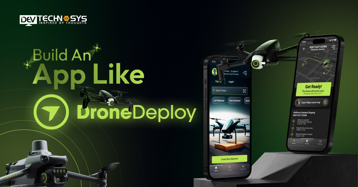
“Map your business earnings by developing DJI apps similar to DroneDeploy.”
Do you run a construction site, farm land, or event management business? If the answer is yes, then using drones for surveys, photoshoots, and crop monitoring is beneficial. For tracking progress, storing information, and predicting results digitally, it is important to build an app like DroneDeploy. These apps are helping multiple businesses in various industries.
It is necessary to justify the need to make an app like DroneDeploy for managing drones without any human intervention. They provide a lot of features that allow users to set timers for inspection and display interactive results through AI.
We will understand the basics of the app, benefits, development stages, features, and cost, in this blog. So, let’s dive into it.
What is DroneDeploy?
Real-time image collection, automated drone flights, and photogrammetry-based map and 3D model building are all made possible by DroneDeploy. It is a cloud-based aerial mapping and data analytics platform. The platform is among the top Agtech apps to use that enables experts in various sectors like construction, inspection, and agriculture to make accurate judgments by utilizing aerial insights.

- Global Market Size: Estimated at $73.06 Billion, projected to reach $163.6 Billion by 2030, with a growth rate of3% CAGR from 2025 and 2030.
- North America: Dominates the market with over 39% share, and the U.S. drone market is expected to grow at a rate of 13% CAGR through 2030.
- Commercial Drone Segment: Valued at $30.02 Billion, growing at a rate of 6% CAGR between 2025 and 2030.
- Global Commercial Drone Services: Expected to hit $42.8 Billion by 2025, with agriculture accounting for $5.7 Billion that is maximum.
- Commercial Drone Market: Projected global growth from estimated $36.4 Billion to $95.4 Billion, growing at a rate of 1% CAGR at the ending of 2030.

How Does DroneDeploy Work?
DroneDeploy is a cloud-based platform for drone mapping and analysis that streamlines the process of gathering aerial data. Users can easily create real-time maps and 3D models by taking pictures:

1. Drone & App Setup
Users use a controller or Wi-Fi connection to link their compatible drone and build mapping for DJI app. The app sets up camera settings for the best possible image capture and guarantees mobility.
2. Flight Planning
By sketching the mission region on the app’s map display, users can construct a personalized flight path. To guarantee data accuracy, parameters including speed, overlap rate, and altitude are selected.
3. Autonomous Drone Flight
Without human intervention, the drone takes off and autonomously follows the predetermined flight route. It is used as Agtech solutions that cover regions by taking geotagged photos at regular intervals.
4. Image Upload & Processing
Pictures are uploaded to the DroneDeploy cloud platform after the flight is over. The software uses photogrammetry to stitch them into elevation data, 3D models, and 2D maps.
5. Data Analysis & Reporting
From the created maps, users can use tools to measure volumes, distances, and changes. Stakeholders can receive personalized reports and visual insights to aid in prompt decision-making.
Why Invest in Drone App Development?
The idea to develop an app like DroneDeploy allows process automation, decision-making, and aerial data collection. Investing in drone technology promises significant profits and long-term expansion:

1. Rising Market Demand
With increasing use in construction, logistics, agriculture, and other fields, the worldwide drone market is expanding. Businesses use DroneDeploy app development services to create specialized drone applications for inspections, mapping, and surveying.
2. Real-Time Data Capture
During flights, drone apps provide immediate access to high-resolution photos, videos, and sensor data. This facilitates operational agility, fast decision-making, and reducing the cost to create an app like DroneDeploy. In time-sensitive sectors like construction, these kinds of capabilities are essential.
3. Automation & Accuracy
Drone programs precisely automate image capture, navigation, and flight planning. You can hire an AgTech software development company to improve data reliability, lower human error, and guarantee consistent coverage. Automation saves time on repeated operations and lowers operating costs.
4. Scalable Business Model
Both small and large organizations can benefit from the customization and scalability of drone apps. Scalability is made easy with SaaS choices, modular features, and cloud integration. Targeting new markets and sectors with a low cost to build an app like DroneDeploy is made possible by this flexibility.
5. Support for Diverse Industries
Applications for drones are utilized in mining, real estate, energy, agriculture, environmental monitoring, and other fields. They assist with tasks including infrastructure inspections, site assessments, and crop health analysis.
What is the Use of AI in Developing Apps Like DroneDeploy?
Businesses can make an app like DroneDeploy by using AI which is a great tool for automation. It facilitates real-time decision-making, enhances image identification, and automates data processing.
Applications for drones become more accurate, effective, and scalable using AI. A mobile app development company helps to integrate AI that fulfill the needs of sectors like environmental monitoring, construction, and agriculture.
- Image Recognition: Identifies objects, patterns, and anomalies in aerial images automatically.
- Crop Health Monitoring: Analyzes NDVI/multispectral data to detect plant stress and growth patterns.
- Flight Path Optimization: Uses AI to suggest or adjust routes based on terrain, obstacles, and weather.
- Predictive Maintenance: Detects drone hardware issues before failure using sensor data analysis.
- Smart Data Classification: Categorizes captured data for faster retrieval and insight generation.

How to Make Applications Like DroneDeploy?
Here, we will study the process to build an app like DroneDeploy with detailed information. So, it will be helpful for businesses to easily prepare a budget for mobile app development:

1. Know Drone Industry
A business investor must learn the fundamentals of drone technology, industry norms, and FAA rules first. Examine the applications of drones in a variety of industries, including mining, construction, agriculture, and energy.
Examine the functionality provided by popular programs such as DJI Terra, Pix4D, and DroneDeploy. Determine the most important user requirements to develop an app like DroneDeploy.
- What are the current trends in the aerial data sector?
- Which industries most benefit from drone mapping?
- What limitations exist in current drone applications?
2. Create a Blueprint
To make an app like DroneDeploy, you must create a thorough project plan that outlines the goals, features, and operation of your app. Incorporate data analytics, 3D modeling, map creation, and flight planning tools.
Specify the kinds of drones and camera equipment that your software will work with. Create a tech stack that includes backend tools, native SDKs for mobile devices, and Flutter or React Native.
- What are the core features?
- How will the app architecture support scalability?
- What is the estimated budget?
3. Approach App Experts
It is important to hire developers from an on demand app development company with expertise in real-time data handling, DJI, Parrot, GIS, and drone SDKs. Make sure the team consists of cloud engineers, QA testers, UI/UX designers, and mobile developers.
Select professionals who can create an app like DroneDeploy. Think about collaborating with a development firm that provides post-launch assistance and end-to-end services.
- What skills are required for a development team?
- Why should you hire freelancers?
- How do you evaluate a developer’s experience?
4. Design User Interface
Create a user-centered design that makes difficult jobs like map analysis and mission planning easier. For improved usability, make use of drag-and-drop tools, visual dashboards, and simple navigation. Create distinct panels for surveyors, pilots, analysts, and clients, among other user categories.
Include offline maps, real-time status indications, and flight preview panels. Pay attention to responsive design that works well on desktops, tablets, and smartphones.
- How can the UI simplify complex functions?
- What design standards are consistent across devices?
- How will users be influenced by UI layout?
Interested in a chatbot demo, pricing, or more info? Fill out the form our expert will contact you shortly.
-
Chatbot Demo
-
Cost to Develop an app
-
Industry Report
-
Case Study
5. Integrate Cloud APIs
For safe data processing and storage, connect cloud platforms such as AWS, Google Cloud, or Azure. Incorporate real-time streaming, geotagging, photogrammetry, and 3D reconstruction APIs. Hire a DroneDeploy app development company to use drone SDKs for flight control.
Turn on functions like on-cloud map stitching and automatic image and video uploading. Use scalable architecture to manage numerous users and big datasets.
- Which cloud platforms are best?
- What APIs are needed for drone control and data storage?
- How do you ensure secure API integration?
6. Testing & Launch
Perform thorough testing to ensure that it works, performs well, and is compatible with various drones. To verify battery life, image quality, and flight stability, replicate real-world scenarios. You must use Drone app development services to test devices and platforms for data integrity security.
Based on tester comments, improve functionality, optimize code, and fix issues. After the app is stable, release it with the appropriate documentation for web, iOS, and Android platforms.
- How will you test drone compatibility?
- What scenarios ensure data safety?
- What is the ideal launch plan?
7. Security & Updates
Put security elements like role-based access, secure login, and encrypted data transfer into practice. Verify adherence to FAA aviation standards and data privacy laws like the GDPR. Update frequently to address bugs, enhance functionality, and accommodate new drone hardware.
Utilize analytics to monitor user activity and make app updates in response to actual usage trends. Maintaining app performance, trust, and market relevance is facilitated by security and regular upgrades.
- What security protocols are used to protect drone data?
- How frequently will the app receive updates?
- What compliance standards must be used?
Incredible Features of DJI Apps Like DroneDeploy
DroneDeploy and other DJI-powered apps provide various instruments for automating and capturing aerial data. These characteristics improve precision, safety, and operating efficiency:

1. Automated Drone Maintenance
The app monitors drone health, battery cycles, and component wear automatically. It alerts users for timely maintenance, ensuring longer drone lifespan and safer flights.
2. Real-Time Live Preview
Users get a live video feed from the drone’s camera during flight. This enables immediate visual inspection, adjustments, and real-time decision-making.
3. High-Resolution Mapping
The app captures overlapping images to create detailed 2D orthomosaic maps. These maps are ideal for surveying, construction monitoring, and land assessment.
4. Thermal Imaging Support
With compatible drones, the app supports thermal camera data capture. It’s essential for search & rescue, electrical inspections, and precision agriculture.
5. Crop Health Analysis
AI-powered Agtech apps process NDVI and multispectral imagery for plant health insights. Farmers can detect disease, stress, or irrigation issues early and act quickly.
6. 3D Modeling
Captured images are processed into accurate 3D models of terrains, structures, or assets. This supports applications like BIM, architecture, and volumetric analysis.
7. Offline Flight Mode
Users can download maps and plan missions without internet access. This is useful in remote areas where connectivity is limited or unavailable.
8. Annotation & Measurement Tools
Users can draw, tag, and measure areas, distances, and volumes on maps. It supports detailed reporting and communication between field and office teams.
9. Cloud Sync & Storage
Captured data is uploaded and synced securely to the cloud for access anytime. It enables remote access, processing, and sharing of large datasets effortlessly.
10. Team Collaboration Tools
Multiple team members can view, comment, and analyze flight data in real time. This promotes coordinated workflows and faster decision-making across locations.
11. API & Integration Support
Apps offer APIs to integrate with GIS, BIM, CRM, and third-party analytics tools. This allows seamless data exchange and advanced workflow automation.
12. Multi-Drone Compatibility
The app supports a wide range of DJI drones and camera types. You can create an app like DroneDeploy for users to easily switch between drones based on mission type without changing platforms.
Top 6 DroneDeploy Alternatives
DroneDeploy is a top drone mapping service, but there are a number of strong alternatives that provide weather forecasts, flight automation, and real-time data processing. They are as follows:

1. Litchi
With sophisticated waypoint, orbit, and tracking missions, Litchi is a well-known flight planning tool. It is perfect for accurate, consistent drone flights because it supports VR mode and operates offline.
- Advanced Waypoint Missions: Lets users pre-program complex paths with precise control.
- Virtual Reality Mode: Provides immersive FPV experience using VR headsets.
2. UAV Forecast
UAV Forecast offers wind forecasts, GPS satellite availability, and comprehensive meteorological information. By examining visibility, precipitation, and geomagnetic activity, it assists drone pilots to build mapping for DJI app.
- Weather & Wind Forecasting: Displays real-time and hourly forecasts for wind.
- Satellite & GPS Status: Shows GPS satellite availability and geomagnetic conditions.
3. Ajax PRO
Ajax PRO specializes in industrial asset monitoring and automated inspections. In industries like telecom and energy, it provides defect tracking, mission replay, and real-time telemetry.
- Automated Asset Inspection: Offers customizable flight plans for inspection and reporting.
- Real-Time Telemetry & Replays: Provides live mission tracking and post-flight analysis.
4. Dronelink
Custom flight automation with real-time scripting and 3D mission planning is made possible by Dronelink. Professional users utilize drone service apps because of their cross-platform compatibility and dynamic mission changes.
- 3D Mission Planning: Allows users to plan missions directly on 3D maps.
- Cross-Platform Support: Compatible with iOS, Android, and web interfaces.
5. Drone App
The Drone App is a basic logbook and flight controller app for amateur and semi-professional users. Its user-friendly interface provides basic telemetry, mission planning, and battery management.
- Flight Log & Tracking: Records flight history, GPS paths, and drone metrics.
- Battery Monitoring System: Tracks battery usage and alerts users for timely recharges.
6. Dronecast
Dronecast provides no-fly zone notifications, airspace limitations, and hyper-local weather information. By combining FAA data with customized environmental knowledge, it improves flying safety.
- Hyperlocal Weather Data: Provides location-specific weather insights for drone safety.
- No-Fly Zone Alerts: Warns users of restricted or controlled airspaces using real-time data.

Tech Stack Used to Build an App Like DroneDeploy
A strong tech stack that facilitates drone control, real-time data processing, cloud storage, and user interaction is necessary to develop an app like DroneDeploy.
You can hire mobile app developers for integration with drone SDKs and AI-based analytics. A list of crucial elements and their uses is provided below:
| Component | Application |
| Frontend (React/Flutter) | Builds responsive, cross-platform user interfaces for mobile and web apps. |
| Backend (Node.js/Python) | Handles API requests, business logic, data processing, and server communication. |
| Drone SDK (DJI SDK) | Enables drone control, telemetry access, camera handling, and flight automation. |
| Cloud Platform (AWS/GCP) | Provides cloud storage, data processing, and scalable infrastructure. |
| Database (PostgreSQL/MongoDB) | Stores user data, flight logs, images, and map metadata efficiently. |
| 3D Mapping Library (Cesium/Mapbox GL) | Renders 3D models and interactive maps from aerial imagery. |
| Photogrammetry Engine (Pix4D Engine/OpenDroneMap) | Processes drone images into maps, 3D models, and elevation data. |
| Real-Time Communication (WebSocket/Socket.io) | Enables live drone feed, telemetry updates, and real-time sync. |
| Authentication (OAuth 2.0/Firebase Auth) | Secures user login and manages roles/permissions. |
| Analytics & Reporting (Power BI/Grafana) | Visualizes flight data, inspections, and user behavior trends. |
What is the Cost to Develop an App Like DroneDeploy?
There are several elements that affect the cost to build an app like DroneDeploy. Technical features, developer experience, and long-term operating requirements all affect the final costs. Better resource allocation and financial planning are made possible by an understanding of these aspects:

1. Project Complexity
The cost to develop an app like DroneDeploy increases with advanced features like real-time mapping, 3D modeling, or AI-based analysis. It takes longer to create, integrate, and test complex capabilities. The cost of apps with offline support, scalable design, and multi-drone compatibility is much higher.
| Project Complexity | Development Time | Estimated Cost |
| Simple | 2-5 months | $5000-$10000 |
| Moderate | 5-8 months | $10000-$15000 |
| Complex | 8-12 months | $15000-$20000 |
| Premium | More than 12 months | $20000-$25000 |
2. Developers’ Experience
The survey app development cost usually goes up when you hire drone tech experts or experienced engineers. Experts produce superior architecture, quicker debugging, and high-quality code. Their knowledge can, however, lower technical debt and long-term dangers.
| Developers’ Experience | Cost Estimation |
| Junior/Entry-Level | $8000-$12000 |
| Mid-Level/Experienced | $12000-$16000 |
| Senior/Expert | $16000-$20000 |
| Professional | $20000-$24000 |
3. Demographics
Regional differences in development expenses mean that developers in the US and the UK charge more than those in Asia or Eastern Europe. If properly managed, offshore development can save expenses by as much as 60% without sacrificing quality.
| Demographics | Estimated Cost |
| USA | $25000-$30000 |
| Australia | $20000-$25000 |
| India | $5000-$12000 |
| UK | $15000-$20000 |
| UAE | $8000-$15000 |
| Brazil | $12000-$16000 |

4. Team Hiring
The overall cost to hire dedicated developers is increased when a full-stack development team of designers, developers, QA engineers, and project managers is hired. Freelancers can save money up front, but they are not scalable or reliable in their work.
| Hiring Model | Estimated Cost |
| In House Team | $5,000-$8,000 |
| Full-Time Freelancers | $3,500-$5,000 |
| Developer Outreach | $8,000-$15,000 |
5. Maintenance Charges
The DroneDeploy app development cost for bug repairs, feature improvements, SDK updates, and server maintenance is crucial. 15% to 20% of the initial development expenditure may go toward annual maintenance. Ignoring maintenance can result in user attrition, outdated technology, and app problems.
| Component | Estimated Annual Cost |
| Bug Fixes & Updates | $3,000 – $8,000 |
| SDK/API Upgrades | $2,000 – $6,000 |
| Server & Cloud Costs | $5,000 – $12,000 |
| Technical Support | $2,000 – $5,000 |
How to Make Money From DJI Apps Like DroneDeploy?
To balance the cost to make an app like DroneDeploy by combining scalable business strategies, you need to monetize DJI-based drone apps. These applications provide a range of revenue streams:

1. Subscription-Based Model
Provide tiers of price for access to essential and upscale capabilities such as cloud storage, analytics, and 3D mapping. Depending on their degree of usage and the features they need, users can choose to subscribe monthly or annually.
2. Custom Industry Solutions
Create specialized drone solutions for industries such as mining, construction, energy, and agriculture. Charge more for enterprise support, analytics dashboards, and special integrations. High-value clients with specific needs and bigger expenditures are the focus of this strategy.
3. Drone Services Marketplace
Provide a platform that allows businesses and drone pilots to collaborate on tasks like surveying, mapping, and inspection. For every work that is posted or finished, charge a commission or listing fee. For example, a drone in medicine delivery creates income through service facilitation.
4. Data-as-a-Service (DaaS)
Sell access to historical or real-time datasets to generate revenue from gathered aerial data. It is necessary to balance the cost to develop an app like DroneDeploy for insurance, urban planning, and agriculture. Provide curated, high-quality datasets for one-time access or subscriptions.
5. White-Label Licensing
With your technology powering the backend, you may license your app to other businesses under their branding. Charge recurring royalties and setup costs for access and personalization. This is perfect for B2B scalability since it increases reach without incurring direct operating costs.
6. API Access for Enterprises
Offer APIs for data analysis, drone control, and interaction with external systems such as CRM or GIS. Businesses are charged for API access according to the amount of data points or consumption. This opens up a high-margin revenue stream while empowering developers and companies.

Let’s Summarize!!
Now, it’s time to approach an Aviation software development company like Dev Technosys to build an app like DroneDeploy at affordable rates. As a business investor, you can connect our experienced developers to get:
- Access on multiple DroneDeploy app development services from consulting to maintenance.
- Examine different business models for developing apps similar to DroneDeploy.
- Techniques to reduce the cost to create an app like DroneDeploy.
- Monetization methods for revenue generation.
The above points are very useful for an entrepreneur to gather users in large numbers and make profit with consistent income.
FAQs
1. Which are the Best Alternatives of DroneDeploy in the USA?
SiteScan by Esri, Pix4D, DJI Terra, Propeller Aero, and Skydio 3D Scan are a few of the best alternatives for DroneDeploy. These platforms provide sophisticated 3D modeling, mapping, and surveying technologies suited to many sectors.
2. How DroneDeploy Capture Images and Videos?
- It creates pre-planned flight missions.
- The app utilizes mounted cameras for high-quality images and videos.
- Captured visuals are stored locally for cloud processing.
3. How Long Does it Take to Build an App Like DroneDeploy?
Depending on its complexity and scale, creating a fully functional program like DroneDeploy usually takes 6 to 9 months. While more complex elements like AI and 3D mapping take longer to construct, basic versions can be finished in three to four months.
4. What is the Maintenance Cost of DJI Drone Applications?
Depending on the app’s size and usage, maintenance for DJI-like drone apps can range from $1,000 to $5,000. Bug patches, performance enhancements, SDK upgrades, and cloud storage costs are all covered. Drone security, accuracy, and compliance are guaranteed by routine maintenance.
5. How Much Does it Cost to Hire Dedicated Developers?
Depending on region and skill level, hiring dedicated developers can cost anything from $10 to over $60 per hour. Prices differ because US-based professionals are more expensive than offshore developers. Pricing is impacted by expertise in real-time data processing, GIS, and drone technology.
6. Are Apps Similar to DroneDeploy Safe to Use?
Yes, the majority of apps, including DroneDeploy, are secure because they employ user access controls, secure data storage, and end-to-end encryption. Additionally, trustworthy platforms adhere to SOC2, GDPR, and FAA requirements.