


Navigation is the key to the open sea, and Marine Navigation Software is the compass of the modern mariner.
– Jacques-Yves Cousteau
Navigation in the vast open sea is a difficult task that requires precision and sophisticated technology. This blog will take you on an adventure to learn about the intricate details to build a marine navigation software. We’ll explore the key components of this essential tool for mariners, from GPS systems to chart plotting and radar integration.
We will discuss the underlying technology, data sources, and key considerations to guide you through the design process for a robust and user-friendly interface. It is aimed at sailors and maritime professionals.
This blog is a great resource for software developers who want to enter the maritime industry or seafarers looking to gain a better understanding of the process to build a marine navigation software. Come along on an exciting journey into the world of marine technology.
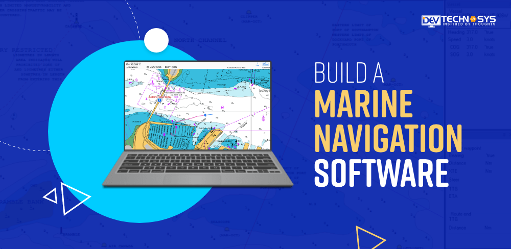
What is Marine Navigation Software?

Marine Navigation Software is an application that was developed for Navigation and guidance within marine environments. The software combines different technologies and data sources in order to help sailors and mariners navigate the seas safely and accurately. This software integrates GPS, electronic charts, and radar data with weather data and other relevant information to provide real-time position, route planning, and collision avoidance.
This fleet management software development improves maritime safety and efficiency by helping vessels navigate through complex waterways and avoid hazards. Marine Navigation Software, also known as Marine Navigation Software, is an essential tool for seafarers today. It ensures precise and reliable Navigation in the open water.
8 Popular Marine Navigation Software
In this section, we have covered popular fleet management solutions which you must know for research purposes.
| Software Name | Description |
| 1. OpenCPN | An open-source navigation software with chart plotting capabilities. It’s free to download and use. You can find it on OpenCPN’s official website. |
| 2. MaxSea | A professional marine navigation software known for its advanced features. You can download it from the MaxSea website. |
| 3. SeaClear | A free PC-based chart plotter for Windows. You can download SeaClear from various sources on the internet. Be sure to download from a reputable source. |
| 4. Nobeltec | Offers various marine navigation solutions. You can find more information and downloads on the Nobeltec website. |
| 5. Coastal Explorer | A navigation and charting software. You can download Coastal Explorer from the Rose Point Navigation Systems website. |
| 6. Raymarine Lighthouse | Raymarine’s navigation software. Check the Raymarine website for downloads and updates. |
| 7. Expedition | A popular software for racing and cruising navigation. You can find more information on the Expedition Marine website. |
| 8. TimeZero | Offers marine navigation software with advanced features. You can download TimeZero from the TimeZero website. |
Features of Marine Navigation Software
Before you dive into the process to create marine navigation software you must know some incredible features. We’ll cover the main features of the admin panel and the user panel of marine navigation software in this short overview.

Admin Panel Features:
1. Vessel Management
Admin panel allows the administrator to add, remove, and manage vessels in the fleet. The admin panel provides detailed information about each vessel, including its specifications and maintenance history, as well as crew assignments.
2. Route Planning
Administrators can plan routes and modify them for vessels, taking into consideration factors such as weather conditions, traffic, and safety zones. They can also define no-sail areas and set waypoints.
3. Weather and Environmental Data
It is essential to have access to weather and environmental data in real-time for optimal route planning. The admin panel gives access to marine traffic, weather forecasts, and sea conditions.
4. Safety Alerts & Notifications
This software allows you to set up and configure safety alerts in the event of critical events, such as severe weather warnings or equipment malfunctions. These alerts are available in real-time to administrators.
5. Crew Management
The admin can schedule shifts, manage crew assignments, and monitor certifications. This feature makes sure that the vessels are adequately staffed by qualified personnel.
6. Maintenance and Inventory Tracking
The admin panel has tools to track maintenance schedules, spare parts availability, and equipment on each vessel. The admin panel helps to ensure that the vessels are always maintained in optimal condition.
7. Compliance and Reporting:
It helps in the generation of compliance reports that meet safety and industry standards. These reports may include information on the routes taken, safety precautions, and compliance with regulations.
8. Remote Support and Access:
Remote access to the onboard systems is often possible via the admin panel for maintenance and troubleshooting. This is particularly useful in the event of technical problems at sea.
User Panel Features:
1. Navigation and Charting
It allows crew members to monitor the vessel’s location, navigate in real-time, and chart charts. They can view electronic charts, set waypoints, and receive course suggestions.
2. Safety Information
It gives immediate access to safety data, such as alerts regarding nearby vessels, collisions that may occur, or warnings about changing weather conditions.
3. Communication:
The marine GPS Navigation Software allows crew members to communicate with the administration team or other vessels using features such as messaging and radio communication.
4. Maneuver Assistance:
The user panel includes many features, such as autopilots and semi-autonomous navigators. Crew members can program the software to help with course corrections, maneuvering, and other tasks.
5. Environmental Sensors:
The crew can monitor environmental sensors onboard, including temperature, humidity, and wind speed. To include this feature in your process to build a marine navigation software you must get in touch with the AI Development Services providers.
6. Navigation History
The navigation history of the vessel allows crew members to review past routes and conditions. Ensure to add this feature in your process to build a marine navigation software for successful results.
7. Emergency Protocols
The user panel has emergency protocols that allow crew members to access safety procedures and contact information quickly.
8. Documentation and Reporting:
The crew can record incidents, maintenance requirements, and other vital data. These logs can be used for compliance and reporting purposes.
How to Create a Marine Navigation Software?
Now the time has come when you should know the process to build marine fleet management software. Marine navigation software is essential for ensuring safety and efficiency in maritime operations. It’s important to use a structured process when creating software for mariners or recreational boaters. This guide will break down the process to build a marine navigation software.

1. Define Your Business Goals
Prior you develop marine navigation software, you must first define your goals and objectives. What is the problem that your software aims to solve, and what will its value be to users? It could be anything from improving Navigation and safety to route planning, real-time monitoring of the weather, and route planning. Understanding your audience’s needs and identifying them is essential. Your business goals must be specific, measurable, and relevant.
2. Market Research
To gain insight into the competitive landscape and customer preferences, it is important to conduct thorough market research. Find out what your competitor’s strengths and weaknesses are. Surveys, interviews, or focus groups can be conducted with potential users in order to collect feedback and identify gaps.
Compliance with maritime safety and regulatory standards will be essential. You can tailor your best marine navigation software by conducting thorough market research to match the needs and preferences of your target audience.
3. Choose Technology Stack
It is important to choose the right technology stack to build a marine navigation software successfully. It involves selecting the programming languages and frameworks that will power your software. You’ll also need to take into account the real-time processing of data, geospatial capabilities, and connectivity with external sensors and devices.
For backend development, popular technologies include C++, Python, or Java, while JavaScript frameworks such as React or Angular are used for frontend development. Geospatial APIs and libraries such as Mapbox and Google Maps are also worth evaluating.
4. Hire a Team of Developers
You’ll need to hire a marine navigation software development services provider if you want to build a marine navigation software. This team can include software engineers and data scientists. It may also include designers of user interfaces (UI), user experiences (UX), and quality assurance professionals, depending on the complexity and scope of your project.
Think about the expertise needed in geospatial information, real-time communications, and the maritime domain. A team with relevant expertise is crucial for success, whether you work with an external development partner or hire your staff.
5. Select User Interface and User Experience (UI/UX).
The user interface (UI) and the user experience (UX) are key components of custom software development solutions. The user interface (UI) should be intuitive, easy to use, and tailored to the needs of mariners. Take into account factors such as readability under different lighting conditions, touch-friendly interfaces, and accessibility.
UX should be focused on providing clear information, efficient workflows, and responsive feedback for user interactions. Work closely with UI/UX Designers to create wireframes and prototypes and to continuously collect user feedback throughout the process to build a marine navigation software.
6. Development Phase
In this process to build a marine navigation software, you will turn your idea into a functioning marine navigation software. Here is where the technology stack you have chosen comes into play. Build the core functionality of your software, including GPS integration and route planning. Weather data retrieval is also important.
Make sure your software is able to handle large datasets and perform accurate geospatial computations. You may choose to include features such as augmented reality overlays that assist with Navigation, depending on your business objectives. Consider offline functionality in situations where connectivity is limited. Focus on testing and quality control throughout the entire fleet navigation software development phase in order to identify and fix any bugs.
7. Testing
Tests are a crucial phase in the steps to build a marine navigation software as it ensures that your marine navigation software will be safe, reliable, and user-friendly. Functional testing, performance tests, security tests, and usability tests are all part of this. Test the accuracy of the software in terms of Navigation, weather forecasts, and route planning.
Test your marine GPS software in real-world situations, such as with different vessels or environmental factors. Verify your software’s compliance with maritime safety and regulations. Testing with real mariners will provide valuable feedback and can help resolve any issues.
8. Launch
You’re ready to launch your software once it has undergone rigorous testing and been approved by the quality assurance department. Launch your ship navigation software using a marketing strategy that is well thought out. To ensure that users can get the most out of your software, provide training and support. For your software to be successful in the long term, you will need to make continuous updates and improvements.
How Much Does it Cost to Build a Marine Navigation System?
Cost to build marine navigation software varies widely depending on factors such as the complexity, features, functionalities, technology stack, location, and expertise of the development team.
Here is a rough estimate of the cost to build a marine navigation software, design, and other expenses. These are only rough estimates of marine navigation software development cost that can vary greatly.
| Expense Category | Cost Range | Description |
| Development Team | $8,000 – $20,000+ | Hiring developers, project managers, and quality assurance specialists. |
| Technology Stack | $3,000 – $5,000 | Licensing for software tools and libraries, server costs, and cloud hosting. |
| Design and User Experience | $2500 – $5,000 | UI/UX design, wireframing, and prototyping. |
| Geographic Data | $1,000 – $3,000 | Licensing or acquisition of geographic data and maps. |
| Features and Functionality | $25,00 – $6,000+ | Cost can vary depending on the complexity of the software and the number of features. |
| Testing and Quality Assurance | $2,000 – $4,000 | Testing the software for bugs, security, and usability. |
| Maintenance and Updates | $10,000 – $20,000+ | Ongoing costs for updates, bug fixes, and technical support. |
The cost to develop fleet management app can vary from $8,000 to $25,000. Marine navigation software can be complex and expensive. It may require specialized knowledge or need to adhere to industry regulations. Marine navigation software must also be maintained and updated regularly to ensure accuracy and safety.
It is recommended that you consult a marine navigation expert or a software company to get a more accurate cost to build a marine navigation software. They can assess your requirements and give a detailed breakdown of the cost of custom software development.
8 Reasons to Invest in a Marine Navigation System
Marine navigation software is crucial to the safety and efficiency of maritime operations. Due to the growing reliance of the maritime industry on technology, build a marine navigation software is a profitable and strategic decision. This section will explore eight compelling reasons to build a marine navigation software.

1. Growing the Maritime Industry
The maritime industry is a vital component of global transportation and trade. The maritime industry is responsible for moving people, goods, and energy resources across the globe. The global economy is growing, and so too is the need for reliable and efficient navigation systems. This ever-growing market offers an opportunity for on demand app development services providers to build a marine navigation software.
2. Enhanced Safety
In the maritime industry, safety is of paramount importance. Navigation software that is accurate and reliable can reduce the risk of accidents, collisions, and groundings. Modern navigation systems include features such as real-time weather, collision avoidance, and route optimization. All of these contribute to safer journeys. You can protect assets and lives by investing in safety-enhancing software.
3. Comply with the Regulations
Regulatory bodies such as the International Maritime Organization mandate the use of electronic chart display systems and information systems for commercial vessels to ensure safe Navigation. By investing in marine navigation software that complies with these regulations, shipowners, and operators are able to operate safely and legally. This compliance with regulations can be an important selling point in the market for your software which you can adapt by hiring GPS tracking app development services providers.
4. Cost-savings and Efficiency:
The profitability of maritime operations is heavily dependent on efficiency. Developing robust navigation software helps vessels reduce fuel consumption and operational costs, optimize routes, and reduce their operating costs. Your software can save shipowners money and reduce their carbon footprint by providing tools for better voyage planning, fuel efficiency, and operational efficiency.
5. Real-time Data and Connectivity:
Connectivity is increasingly important in the maritime industry. Modern navigation software provides real-time information on weather, traffic, and other vessels to help make informed decisions. This Hybrid Mobile App Development allows vessels to remain connected with shore support, improving communication and emergency response abilities. By offering data and communication solutions that are reliable, your software can contribute to the trend of connectivity.
6. Scalability and Adaptability:
Investing in marine navigation software allows for flexibility and scalability. The software can be tailored to suit different vessel sizes and types, ranging from small fishing vessels to large container ships. The software can be adapted to various operating conditions in coastal waters, oceans, or icy areas. Software that can be tailored to meet a wide range of requirements allows you access to a variety of market segments.
7. Market Opportunities and Competitiveness
The marine navigation software industry is highly competitive and dynamic. It continues to change with the advancement of technology. You can discover new opportunities to innovate by entering this market. Offer unique features, enhanced user interfaces, and cutting-edge technology to attract customers who are looking for better enterprise mobility solutions.
8. Environmental Responsibility:
The maritime industry faces increasing pressures to reduce its impact on the environment. Green initiatives and regulations become more stringent. You can achieve sustainability by investing in navigation software that promotes eco-friendly practices. Features like optimized routing for reducing emissions, fuel-efficient Navigation, and support of clean energy sources can contribute to an environmentally friendly marine mapping software industry.
In A Nutshell!
Building a marine navigation program is a highly complex but valuable undertaking. It requires meticulous planning, a dedicated team of developers, and compliance with maritime laws. Costs and timelines can be affected by the features and complexity of software.
A reputable marine navigation software development company, such as Dev Technosys, can help streamline the process to build a marine navigation software. Investment in the process to build a marine navigation software as it can offer many benefits to the maritime sector, including increased safety, efficiency, and data-driven decisions.
FAQs
1. How Much Does It Cost To Build a Marine Navigation Software?
The cost to build a marine navigation software can vary significantly depending on the features and complexity. Basic systems may start at $8,000, while more advanced solutions can cost $25,000, including ongoing maintenance and updates.
2. How Long Does It Take To Build a Marine Navigation Software?
The development timeline for marine navigation software typically takes around 6 to 18 months. It depends on the marine charting software complexity, features, and the hire software developers expertise.
3. What Are The Benefits of Investing in Marine Navigation Software?
Investing in marine navigation software offers several benefits, such as improved vessel safety, route optimization, reduced fuel consumption, enhanced compliance with regulations, and better decision-making through real-time data.
4. Why Should You Choose Dev Technosys To Build a Marine Navigation Software?
Choosing Dev Technosys to build a marine navigation software as its advantage due to our expertise in maritime technology, a strong track record, experienced developers, and commitment to delivering customized, reliable solutions.
5. How Can You Make Money From Marine Navigation Software?
You can make money from marine navigation software through various monetization strategies, including licensing fees, subscription models, selling data services, offering premium features, and providing maintenance and support packages to maritime businesses and operators.